Alphabet Challenge: Riverside To San Diego

The latest leg in my Alphabet Challenge flights on PilotEdge: KRAL to KSAN. Based on few viewer requests, this is a full flight with no edits and runs about an hour in length. It’s also over orthophoto scenery, so the view is nice. Pop some popcorn or pour a drink and enjoy the flight.

A wrinkle on this hop: a blown tire on takeoff.

As always, thanks for watching.

Alphabet Challenge: L (KLGB) To M (KMYF)

It’s been some time since the last Alphabet Challenge flight and I was eager to get back on PilotEdge and fly one. No video this time, and I really enjoyed doing a nice flight down the simulated California coast, enjoying the views and the ATC chatter along the way, and experiencing the new dimension of simulation brought by the new Buttkicker (one of the highlights – feeling the gear lock up over the rumble of the engine).

Long Beach in LA to Montgomery Executive outside of San Diego seems straight-forward, but in many ways it’s not. Here’s the chart and route:

ForeFlight_Web 3

There are more than a few airspace challenges here: stay out of the LA Bravo, transition the KSAN Charlie, avoid the R-2503B&C restricted area, manage the Palomar Delta, and stay out of the relatively complicated San Diego / Miramar Bravo shelfs near KMYF. The answer? Pick up ATC advisories, which makes the Charlies and Deltas go away, fly at 3,500 which navigates the Bravos, and hang a left at Mt. Soledad to stay clear of the Miramar and San Diego surface shelfs. All went according to this plan, thanks to the great service from PilotEdge ATC. And the weather was great, too, which made for some fun ORBX sight seeing (along with watching the very busy PE drone traffic zooming about):

PEaware____N15JG_KLGB-KMYF

Next up is M to N, Montgomery to Yuma (KNYL). 128.6 miles as the crow flies, and maybe I’ll get this in over the next couple of days. Here’s the challenge progress so far:

Alpha_Challenge_In_Progress_3

Alphabet Challenge Leg 11: K (KKNB) to L (KLGB)

Yesterday I was able to carve out about three hours to complete the next flight in the PilotEdge Alphabet Challenge, Kanab (K) to Long Beach (L). This is one of the longest flights in the series, logging in at 345 nautical miles with the route I’d planned, a VFR flight of KKNB MMM LAS DAG POM KLGB. You can see the flight plan here:

ForeFlight_Web

To keep this flight a manageable length, I decided to fly it in the Carenado Cirrus SR22GTSX turbo, which would let me clip along at about 170 knots once I climbed to the 12,500 feet cruising altitude I’d planned. It’s a beautiful airplane in real and simulated life:

Carenado_com

Even with all that horsepower it was going to be about a two hour and five minute flight as we had headwinds, some 20 knots, the entire way. I departed Kanab on the CTAF frequency, and then once I was at 12,500 I picked up flight following by calling the PE LA Center frequency. Things went along fine from there, but there were missteps and complications along the way, each of which had its lessons:

  • Equipment can get in the way. I spent quite a bit of time in the early part of the flight messing with the plane’s autopilot. With a long flight ahead I decided I wanted this one to fly itself quite a bit of the way. But for some reason I couldn’t get it to arm for either altitude or navigation / heading. The Carenado autopilots typically play well with Saitek gear, so this was confusing to me. Eventually, about at the outskirts of Las Vegas, I said to heck with it and flew manual the rest of the way. With the winds this was like riding a wild horse, and it was fatiguing. After doing some research I learned that continued trim input can cause the AP to disengage. I did have the aileron trim tab set, and will test today to see if that in fact was the problem.
  • Don’t forget to actually set the squawk code. I kept waiting to hear “radar contact” from Center but it never came. When I finally asked if they had me they said, “no” and told me to cycle the transponder. I saw I was still squawking 1200, and when I suggested that actually setting the code might help I and the controller had a laugh.
  • Equipment failures happen. On this flight, the display on the FIP that shows my wet compass froze. I futzed with it some then flew via only the G1000 glass cockpit on the iPad. But the buttons on the FIP still seemed to work. I use those to toggle the COM and VOR radios, and in pushing them to see what was what I unknowingly switched over to COM2. After wondering where LA Center was for a while I switched back over to COM 1 and asked if I’d blown through a transition. They said no, but that they’d been looking for me. The redundant system on this is the light on the attenuator panel. That’s not working, and I need to fix it just as I would in a real airplane.
  • There’s more to learn on airspace. As I approached the LA basin I started my descent, assuming that SoCal Approach would handle my transition of the LA Bravo airspace. Not true, as the controller got on to advise me that I should probably get down below the Bravo shelf altitude (7,000 feet there) before going further as they would “not allow you to transition there.” I had been thinking that with flight following they’d handle passing me into the Bravo, but in reality you can only transition the LAX Bravo in a couple of places, and that’s not one of them. So I had to make a circling decent, avoid the Ontario Charlie, then duck under the LA Bravo, all of which you can see in the flight path image below. Normally this is easy but …
  • wind and visibility are real complications. The wind was still howling on the descent, some 20-25 knots, and the plane was all over the place. And Active Sky 16 did a great job of rendering the haze in the LA valley, which limited visibility to about 10 miles. All told, it made for a very stressful, if still simulated, descent between holding onto the airplane, avoiding the Bravo and Charlie airspaces, and not being able to see very far. So distracting, in fact, that the aircraft got too fast and crashed, I think from exceeding the NTE speed. Good thing it’s a simulation, and luckily P3D quickly reloaded so I could continue (you can see this point in the flight path as the little jog in the line above the high 60 marker).

PEaware____N15JG_KKNB-KLGB

  • Controllers can make mistakes, too. The Long Beach tower first gave me one approach, then realized they had the wrong airplane, so they gave me another approach. I though I was too close to the field to make the left hand turn it would require, so I looped north to make the right base into 25L. This confused him, too, but he said no worries and told me to just to head to the numbers for landing.
  • And finally, high-performance aircraft are a different kettle of fish, even in a simulator. Once I was in descent everything in the Carenado seemed to happen very, very quickly. There’s a big difference between 100 or 120 knots in a Cessna 172-182 and 150 knots in the Cirrus, and this is more true on final where you’re coming in at 90 instead of 65-70. I landed the thing, but with the wind and the speed it was rough going. You have to really be ahead of the game not the let the airplane get ahead of you.


All told, the flight felt like a workout, and a very useful training session. The great thing about the sim and the software is that conditions can get quite real, and they can require real decision making. This flight had a lot of them, and I felt like my training brain was working nearly the entire time. I suspect that’s valuable as a student pilot. At least, I hope so.

The next flight is Long Beach to Montgomery Field. This will be my first flight on Pilot Edge into the San Diego area, and I’m looking forward to it. And here’s the challenge progress so far. 112 pilots have started the challenge, and only 59 have made it this far.

Alpha_Challenge_In_Progress_3


Alphabet Chalenge Leg 10: “J” To “K” (And Fun With Thunderstorms!)

I finally was able to fly the next leg in the PilotEdge Alphabet Challenge today, which was Jacqueline Cochran (KTRM) to Kanab (KKNB). This is the fifth-longest flight in the challenge, logging in at 269.9 miles as the crows would fly it. I decided to fly it using GPS navigation as VOR would have lengthened the route even more, so I had only one waypoint along the way, Grand Canyon West (K1G4). This helped make sure I stayed out of the canyon’s no-fly zones (and in that portion of the canyon airspace I needed to maintain at least 7,999 feet MSL). This was the only airspace consideration of note along the way, but to hone my radio skills and give me something to listen to I asked for flight following from PE SoCal approach along the way.

Grand_Canyon__AZ_Interactive_Weather_Radar_Map_-_AccuWeather_com
Real World Radar Would Indicate Trouble Ahead!

The flight was uneventful. I don’t use autopilot, but had no issues with heading or altitude flying the old fashioned way. Things got interesting, though, as I crossed the north rim of the canyon. At that point a simple layer of clouds (injected by Active Sky 16) pretty quickly turned into a line of thunderstorms. I was surprised by this as the weather at departure was VFR all the way. So I checked the real-world radar in ForeFlight, and sure enough: thunderstorms from me to Kanab. I switched off the GTN 750 GPS unit and turned on the REX/MilViz WX Advantage weather radar gauge and started negotiating the weather, working hard to stay below the clouds but above the 7,999 foot canyon minimum. I was quite impressed with how well AS 16 replicated the real world radar echoes. Below is a shot of the sim panel, with the iPad showing the real-world radar on ForeFlight, and the REX WX Advantage Radar in the dash showing the t-storm and rain echoes in the sim. It was really cool.

IMG_4329

Things got skinny. Finally I was able to spot some blue sky through a pass and risked the chance of a downdraft going through. In real life I don’t know that I would have made the same decision, and instead would have tried to put down at nearby Grand Canyon Bar 10.

Once I was out of the altitude restriction I had more room to maneuver, and started to tack back north on a heading to Kanab. AS16 did a great job of rending the winds, turbulence, and clouds. It as all really pretty realistic and my pulse was definitely up. In the end I was able to make the landing on 19 in Kanab without further simulated incident, but it was an interesting flight a good practice for checking carb heat, holding altitude, keeping heading, etc. Here’s the planned route, and the actual route after my weather deviations.

SkyVector__Flight_Planning___Aeronautical_Charts 2

PEaware____N15JG_KTRM-KKNB

Next up: Kanab to Long Beach, the second-longest flight in the series (and only short of being the longest by a mile). And here’s the challenge progress to date.

Alpha_Challenge_In_Progress_3


Alphabet Challenge Update: “I” to “J”

Yesterday I was able to get in a new leg on the PilotEdge Alphabet Challenge, flying from Bullhead / Laughlin (KIFP) to Jacqueline Cochran (KTRM). This as a VFR flight, using the Twentynine Palms VOR and Thermal VORs as navaids. Here’s the chart (click to enlarge):

SkyVector__Flight_Planning___Aeronautical_Charts

I did have an interesting moment on this flight. Right after departure my primary yoke went inoperative (probably because I accidentally unplugged it or its USB cable). This happened just as I was off the runway. As I was trying to get it sorted, and still flying the airplane with the other yoke, Bullhead tower asked me to switch to LA Center. I couldn’t respond, as the push-to-talk switch is on the primary yoke. He called four times, with no response. So as I was trying to fly the airplane, unplug the yoke, plug in the yoke, close down SPAD.neXt, and re-launch SPAD.neXt, I also squawked 7600 for lost communications and made the turn he expected me to make out of departure. In a few minutes I had it sorted and regained communication, but if I hadn’t I would have run the lost comms procedure and then flown to an uncontrolled airport to make a cautions pattern entry and landing.

Item for the “to do” list: configure the PTT switch on yoke #2 …

Here’s the Alpha Challenge progress to date. The next flight is “J” to “K,” which is one of the longer flights in the challenge, Jacqueline Cochran to Kanab.

Alpha_Challenge_In_Progress_3

PilotEdge Alphabet Challenge Update

Since my last PilotEdge Alphabet Challenge post I’ve flown two more legs of the challenge: G (Grand Canyon) to H (Lake Havasu City) and H (Havasu) to I (Laughlin/Bullhead, which is KIFP). Here’s the current map (which you may click to see full-size):

Alpha_Challenge_In_Progress_3

Next up is Laughlin to Jacqueline Cochran Regional airport, just south of Indio, CA and just northwest of the Salton Sea.

PilotEdge Alphabet Challenge Leg 6: Fullerton (KFUL) to Grand Canyon (KGCN)

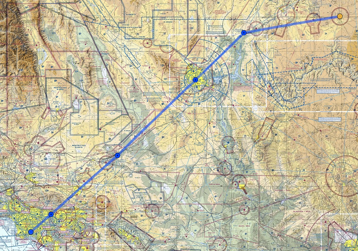
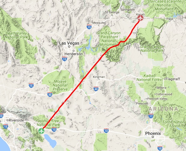
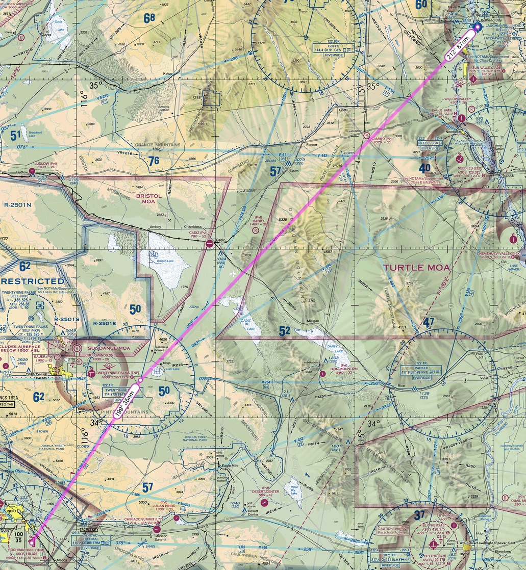
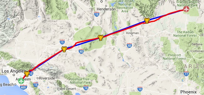
The final PE Alphabet Challenge post for now, leg 6, “F” to “G,” which is Fullerton to Grand Canyon. This is a long hop, over 300 nautical miles and about 2 hours 25 minutes start to finish. The plan was to fly via VOR navigation at 9,500 feet via the Pomona, Hector, Goffs, and Peach Springs VORs, with no GPS and no autopilot just to make it interesting. To save some time I used the A2A Cessna 182.

SkyVector__Flight_Planning___Aeronautical_Charts 3

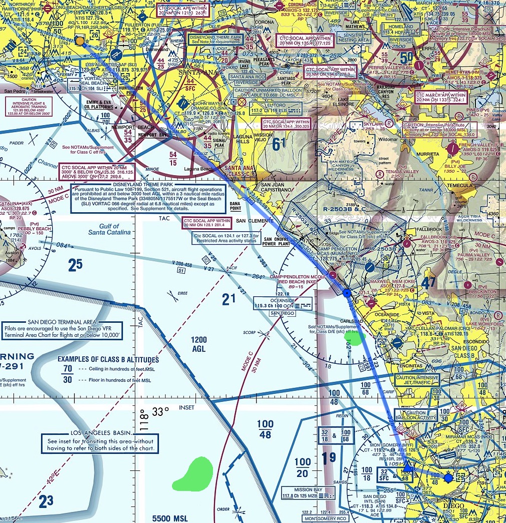
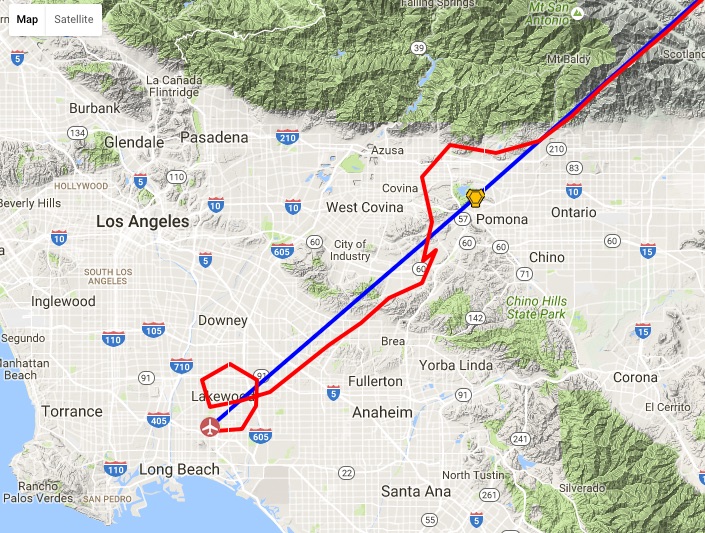
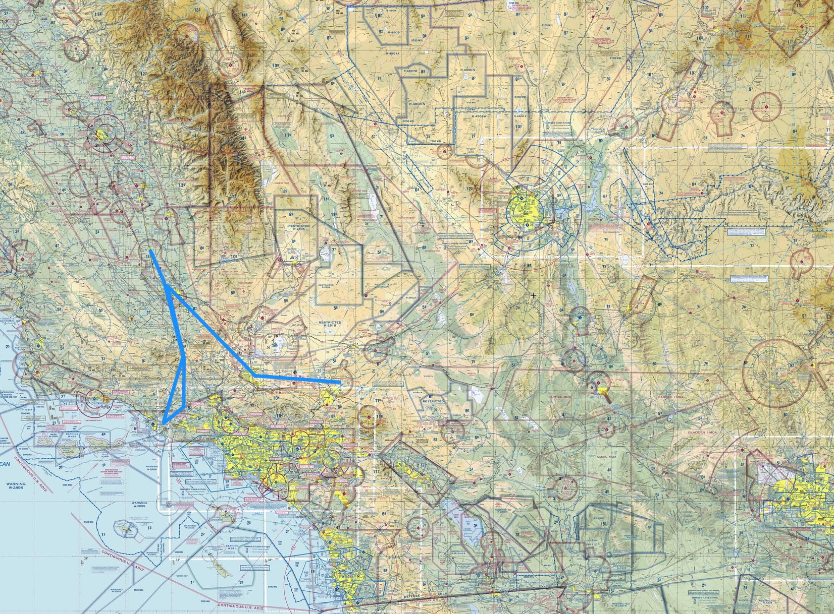
There are at least three major VFR considerations on this flight. The first is the complex airspace departing Fullerton. As you can see below, around the Fullerton airport you have the LAX Bravo (over the top), the Los Alamitos Delta (to the SW), the Brackett Delta (on the way), and the Ontario Charlie (also on the way). One way to fly this VFR would be to make a quick right hand turn on departure, stay below the 4,000 foot LAX Bravo floor, then quickly climb over 5,000 to clear the Brackett and Ontario airspaces. Or you could do what I did, which is just request flight following and talk to ATC the entire way, letting them handle the transitions for you.

SkyVector__Flight_Planning___Aeronautical_Charts 4

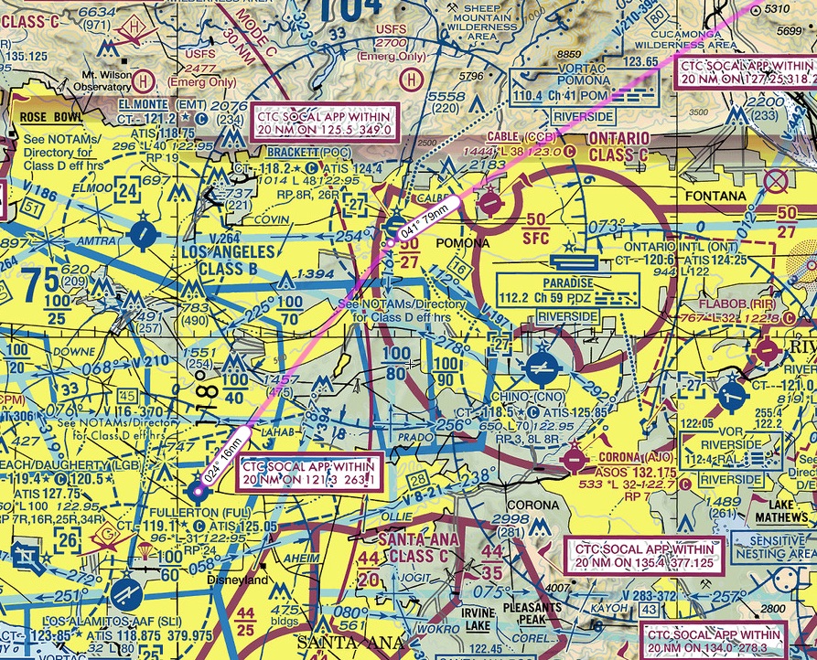
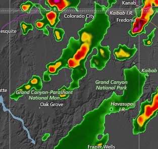
The second VFR consideration are the numerous restricted military training and operating areas along the way. The VOR route I mapped out flies between them. And finally, you have to figure out a place to land if the engine coughs. On this route there are lots of options early, but the rest of the way you’re thinking lake bed, highway, or desert scrub.

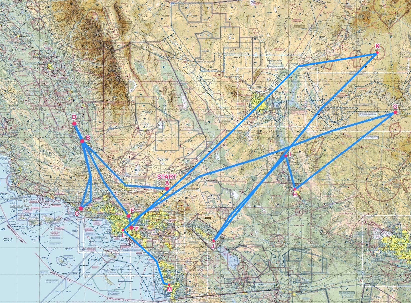
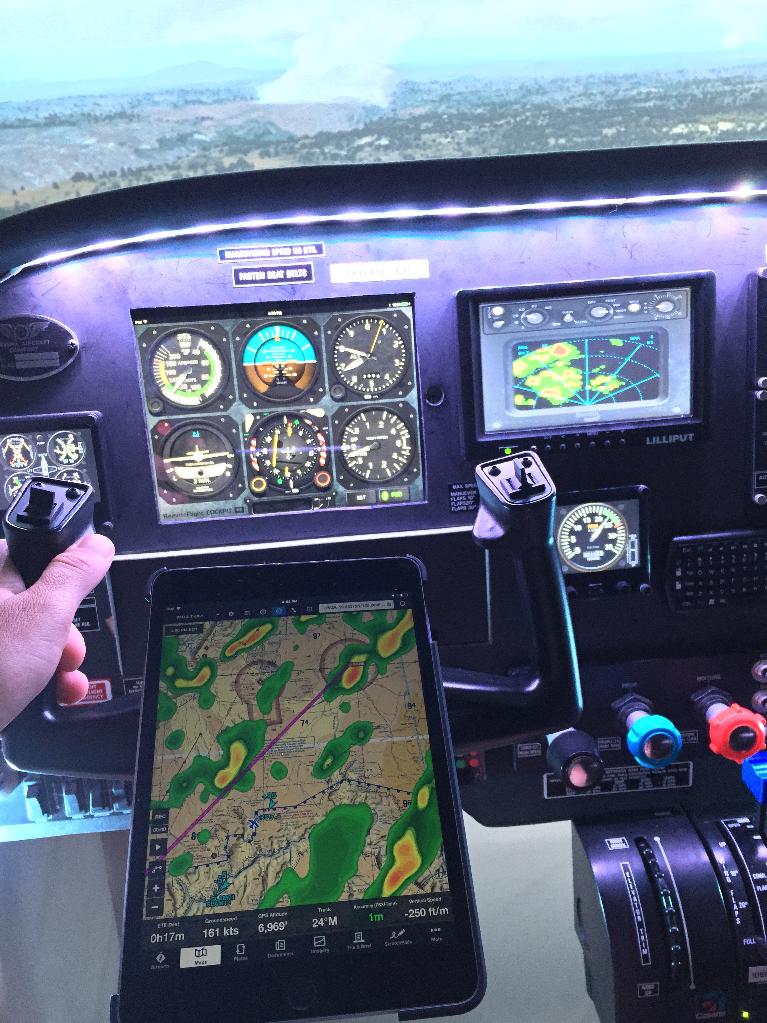
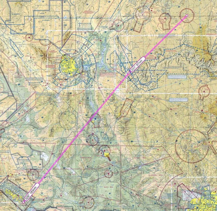
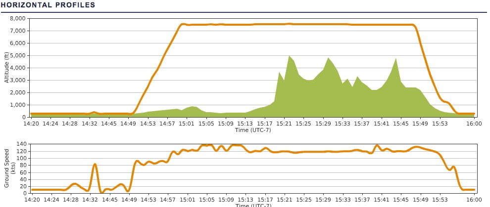
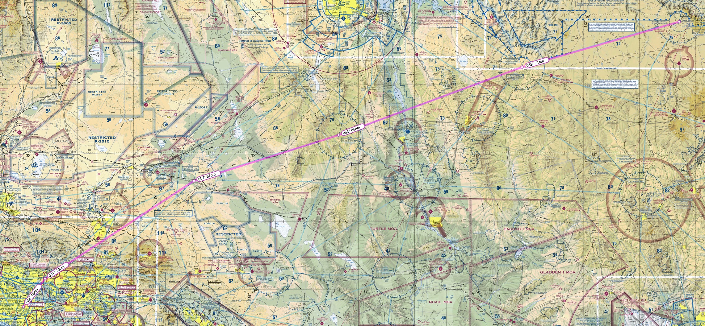
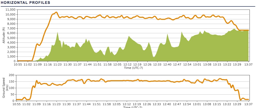
Here’s my actual route of flight and elevation profile. One of the very fair critiques of Prepar3d as a simulator is that it’s harder to trim the aircraft in the sim than in real life. I’ve only had four flights in my real-world instruction so far, but I find this is absolutely the case. It’s almost easier to just manage the yoke continuously than count on the elevator trim to hold an altitude. You can also see the little dip early in the flight where I descended to stay out of the LAX Bravo, which I did not have permission to enter. Finally, I was not yet picking up the Grand Canyon VOR after passing Peach Springs, so I veered a bit south just to stay clear of the Grand Canyon restricted flight area.

PEaware____N15JG_KFUL-KGCN

PEaware____N15JG_KFUL-KGCN 2

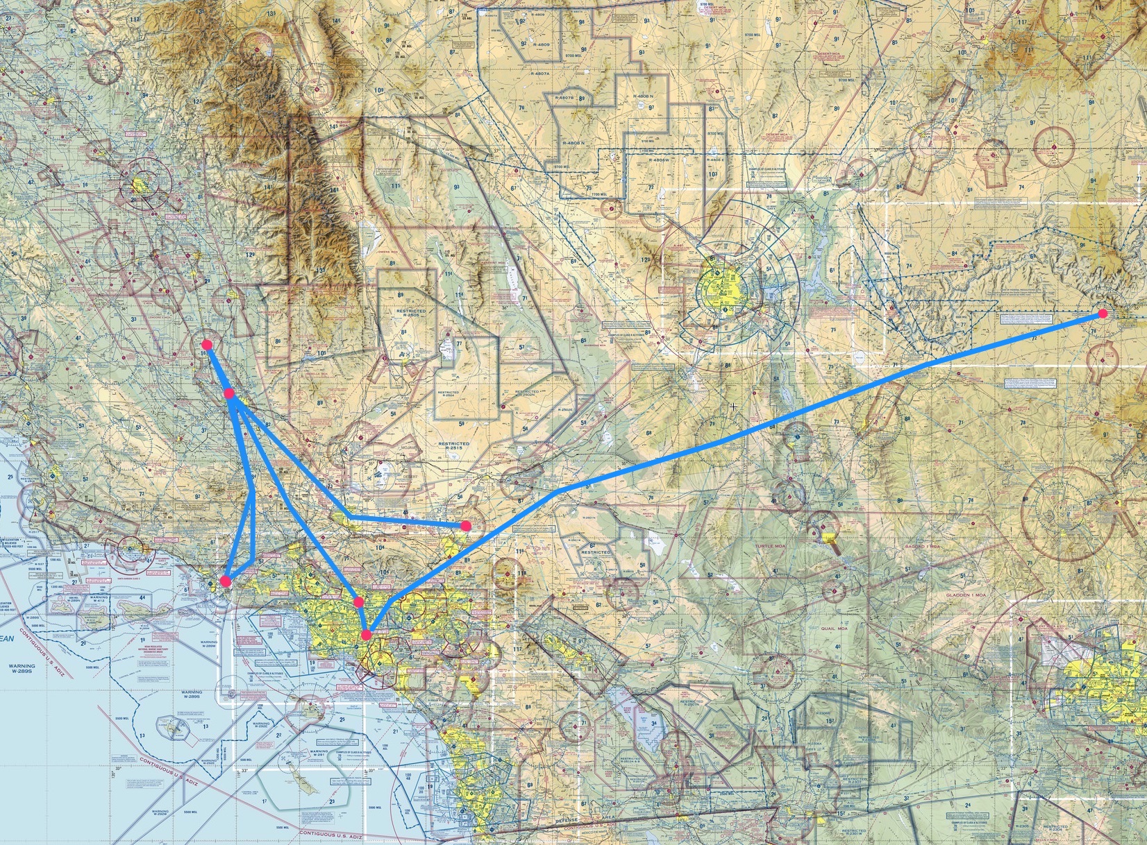
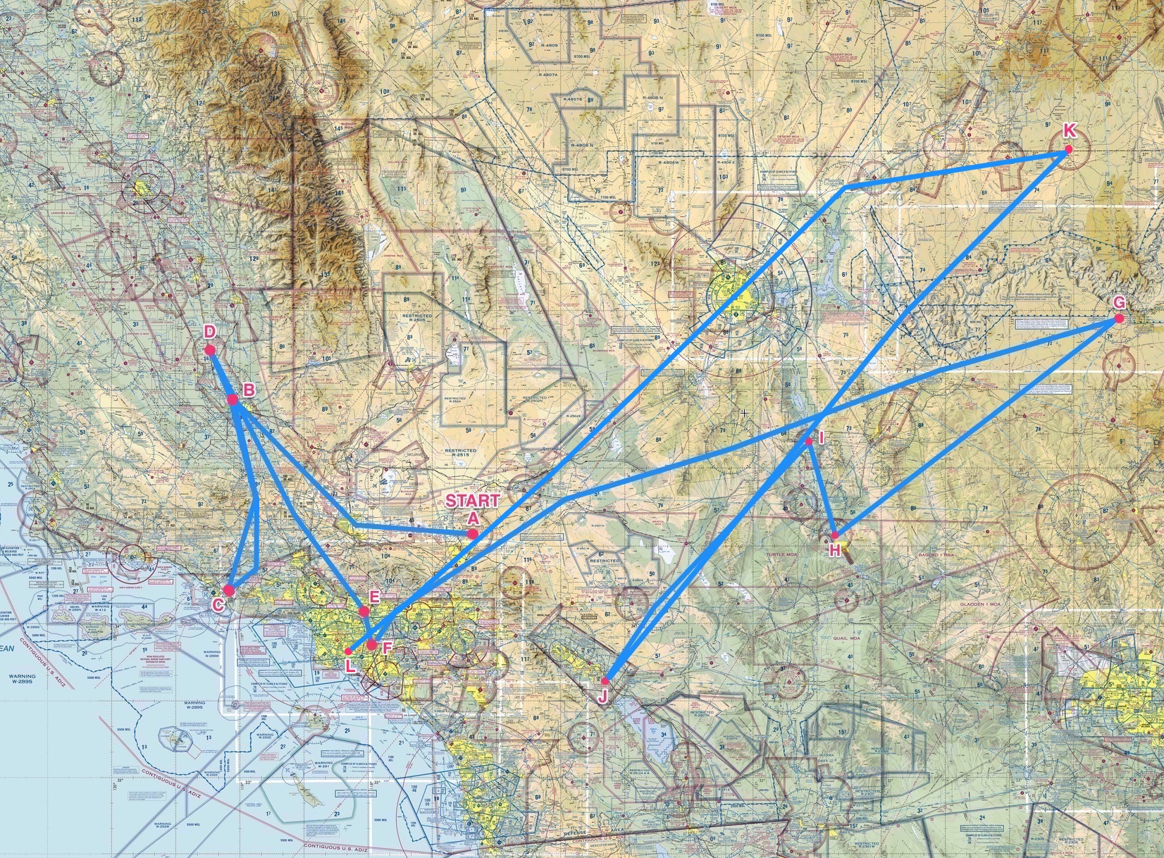
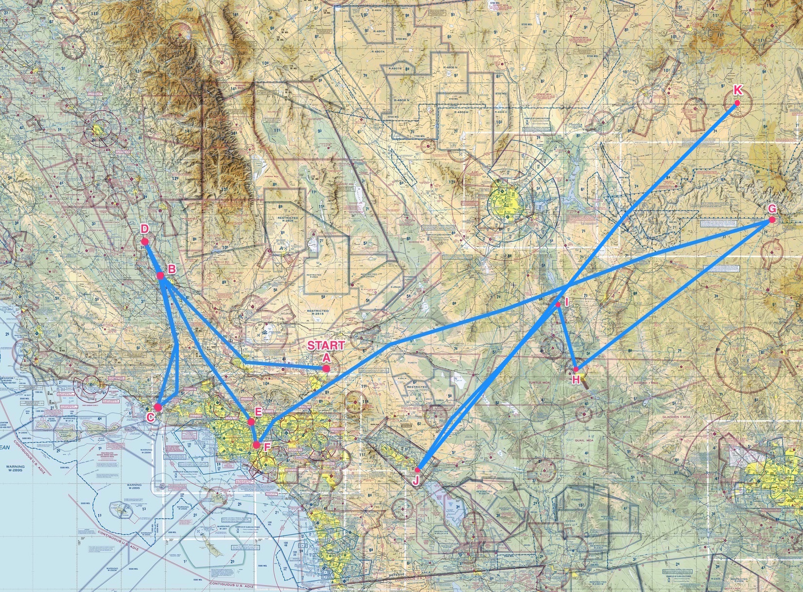
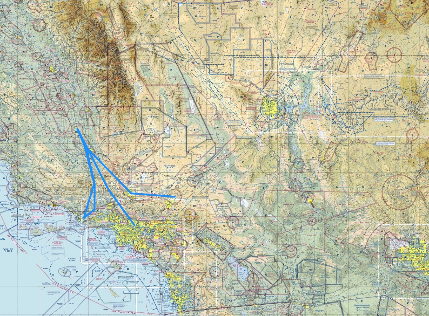
And here’s the current Alphabet Challenge progress map to date, with legs A-F flown (you can click it to see it much larger sized):

Alpha_Challenge_In_Progress_3

PE Alphabet Challenge Leg 4: Delano (KDLO) to El Monte (KEMT)

I’m backed up on a few PE Alphabet Challenge flight posts. Here’s the leg 4, “D” to “E,” which is Delano to El Monte. The plan was to fly VFR with VOR navigation via the Lake Hughes VOR, using the A2A Cessna 172 and autopilot:

SkyVector__Flight_Planning___Aeronautical_Charts 2

You can see what the autopilot does in terms of nice straight vectors and altitude profile:

PEaware____N15JG_KDLO-KEMT

PEaware____N15JG_KDLO-KEMT 2

Have to go up high to clear the mountains and the condor sanctuaries. Here’s the current Alphabet Challenge progress map to date, with legs A-E flown (you can click it to see it much larger sized):

Alpha_Challenge_In_Progress 2


Video: El Monte To Fullerton On PilotEdge

I’ve been away from the simulator for a week traveling, but before I hit the road I videoed leg four of the PilotEdge Alphabet Challenge, El Monte to Fullerton. It’s only about a 10 minute flight, so I recorded it in its entirety as a way of giving folks who may be unfamiliar with PilotEdge a sense of what a simple VFR flight on the network is like. It also showcases the Orbx SoCal scenery, which is fantastic. I hope you like it (rough landing and all).

PE Alphabet Challenge Leg 3: KCMA to KDLO

The other day I flew leg three of the Pilot Edge Alphabet Challenge, which is Camarillo to Delano. For this leg I went old school and analog, flying the A2A C 172 R trainer and using only VOR navigation and the LA sectional chart. No GPS, no ForeFlight on the iPad, and no autopilot. Candidly, it was a ton of fun, and I plan to do quite a few of the rest of the flights this way (save those with more complex airspace transitions where it can be very helpful to know right were you are). Because I flew by hand the entire way you can see my headings and altitudes are a bit variable, but on the whole I did alright.

PEaware____N15JG_KCMA-KDLO

PEaware____N15JG_KCMA-KDLO 2

Here’s my progress on the challenge so far, and the next flight is Delano / KDLO to El Monte / KELM. I hope to fly it later today.

Alpha_Challenge_In_Progress